
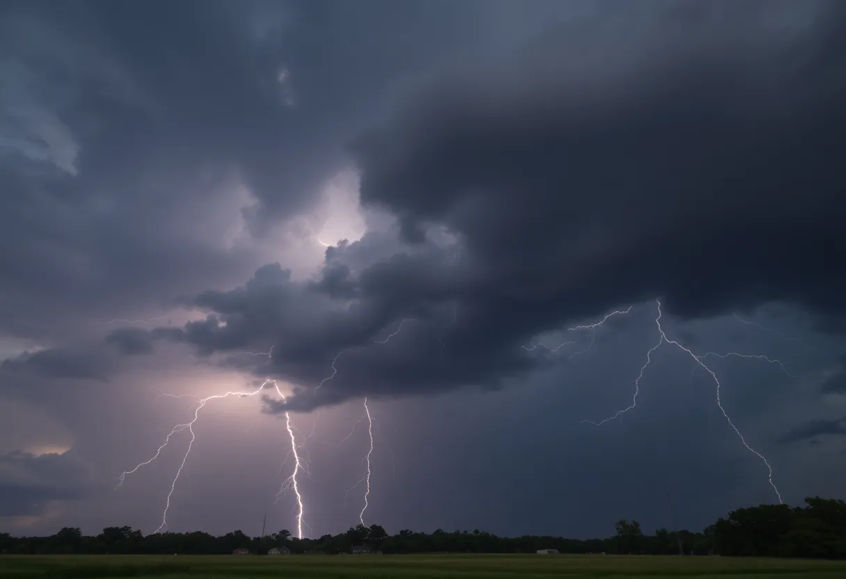
A thunderstorm warning prompts residents of Orangeburg to stay indoors.
Want to target the right audience? Sponsor our site and choose your specific industry to connect with a relevant audience.
Prominent brand mentions across targeted, industry-focused articles
High-visibility placements that speak directly to an engaged local audience
Guaranteed coverage that maximizes exposure and reinforces your brand presence
Interested in seeing what sponsored content looks like on our platform?
May’s Roofing & Contracting
Forwal Construction
NSC Clips
Real Internet Sales
Suited
Florida4Golf
Click the button below to sponsor our articles:
Sponsor Our ArticlesAs the clock struck 11:53 a.m. this Thursday in Orangeburg, South Carolina, a significant weather alert was issued by the National Weather Service (NWS). Residents of Central and Southeastern Orangeburg, including the neighboring counties of Bamberg and Barnwell, were warned to brace themselves for strong thunderstorms through to 12:15 p.m. The forecast included potentially damaging wind gusts that could reach up to 50 mph.
According to the NWS, at precisely 11:52 a.m., Doppler radar indicated a robust thunderstorm developing over Blackville, close to Denmark. This storm is moving eastward at a brisk speed of 45 mph. With such strong winds accompanying the rain, locals should prepare for branches breaking off trees or it being a dangerous day for outdoor debris. Some locations likely to be affected include Bamberg County Airport, the serene Barnwell State Park, as well as communities like Cope and Hilda.
Residents are strongly encouraged to seek shelter *inside a sturdy building* if they are outdoors and haven’t managed to come inside yet. The storm can rapidly escalate, making safety the top priority. The NWS notes that while thunderstorms can be quite common, they often bring unwelcome lightning, which strikes the U.S. about 25 million times per year! With the summer months being peak lightning season, it’s crucial to be aware, as roughly 20 fatalities occur each year due to lightning incidents.
Moreover, with the increased risk of heavy rainfall, drivers should also be cautious about another hazard—*hydroplaning*. This occurs when your vehicle begins to slide uncontrollably across wet roads. Why does this happen? Well, it’s due to water accumulating in front of your tires at a faster rate than the weight of your vehicle can displace it. That pressure can cause your tires to lose contact with the road, leading to a slippery experience.
Now, if you find yourself hydroplaning, it’s important to stay calm. Here’s a quick guide:
Being aware of the potential dangers of thunderstorms, like lightning and wind gusts, can make a big difference in keeping you and your loved ones safe. Make sure to monitor updates from reliable sources to stay well-informed. The alert for Orangeburg County is indeed fleeting, with a brief window for concerns around the strong thunderstorms in effect until 12:15 p.m.
Take care, stay safe, and remember that storms may bring a quick downpour, but together we can weather the storm!
News Summary In a shocking incident in South Carolina, 18-year-old Simon M. Welch was arrested…
News Summary Greenville, South Carolina, recently celebrated Michelin's 50th anniversary in the state and 35…
News Summary Spartanburg, South Carolina, has witnessed a significant 65% surge in its tourism sector…
News Summary Wells Fargo Advisors shares essential financial strategies tailored for new graduates and those…
News Summary The Savannah Police Department is actively investigating a series of violent incidents, including…
News Summary The annual 'Dancing with Our Stars' fundraiser, organized by the Child Abuse Prevention…