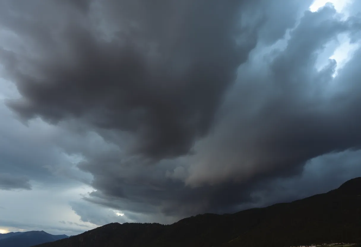
Dark storm clouds signal a severe thunderstorm warning in Upstate South Carolina.
Article Sponsored by:
Mays Contracting is more than just a roofing company; it’s a family legacy built on trust and quality. Founded in 1979, we’ve been serving the community for over four decades. Our story began with a simple vision: to provide exceptional roofing services for both residential and commercial properties. This vision has guided us ever since, as we’ve grown from a small, family-run operation to a trusted name in the industry.

Residents in Upstate South Carolina are on alert as a severe thunderstorm warning has been issued by the National Weather Service. The warning, which is effective until 5:15 a.m., affects areas including Pickens Mountains, Greater Oconee, and surrounding towns. Wind gusts may reach up to 50 mph, and caution is advised as lightning strikes become more frequent. As local authorities prepare for potential impact from Hurricane Helene, community safety measures are being enacted, including the closure of schools and the Greenville Zoo. Residents are urged to stay indoors and stay informed.
As the sun began to rise on Sunday, a wave of excitement and a little bit of anxiety hit the residents of the Upstate South Carolina area. At 4:50 a.m., the National Weather Service issued a severe thunderstorm warning, signaling that the weather was about to take a wild turn.
This alert is effective until 5:15 a.m. for the Pickens Mountains, Greater Oconee, and Greater Pickens areas. It’s essential to stay alert and take precautionary measures. Those living in Toccoa, Seneca, Walhalla, Clayton, and several other nearby towns are in the storm’s path, meaning they could experience some hefty weather challenges.
The biggest surprise? Wind gusts could reach up to a shocking 50 mph. Can you imagine that? Doppler radar tracked thunderstorms moving east at nearly 65 mph, with storms stretching from 10 miles east of Hiawassee to 10 miles northwest of Homer. If that doesn’t make you want to stay indoors with a hot cup of coffee, we don’t know what will!
As the skies darken and the winds pick up, residents are reminded to seek shelter indoors. Those who are out and about should hurry back to safety. The gusty winds can lead to downed tree limbs and projectiles flying from unsecured objects, making it risky for anyone outside. Staying safe is the name of the game!
And let’s talk about lightning for a moment. Annually, there are about 25 million lightning strikes across the United States, and during thunderstorms, the chances of being struck significantly increase. It’s a good time to remind everyone that being indoors is the safest way to ride out this storm, especially when the lightning starts dancing in the sky.
This severe thunderstorm warning comes on the heels of a previously issued tornado alert, which has now expired as the storms weakened. However, the potential for gusty winds remains a concern, with a new warning in effect until 5:45 a.m.. Keep your ears perked for updates and stay tuned to local news or NOAA Weather Radio for the current situation.
But the weather isn’t just stopping there. South Carolina Governor Henry McMaster declared a State of Emergency in preparation for Hurricane Helene, which is expected to hit the area with heavy rainfall, dangerous flooding, and possibly even isolated tornadoes. With anticipated rainfall between 8-10 inches and some areas facing up to 12 inches, it’s going to be a rainy couple of days.
Local power outages have already been reported, particularly in Greenville County, where administrative offices have closed. The community is bracing for potential flash flooding, especially in areas like Anderson and Central Greenville. Roads are currently being reviewed for debris and downed trees, and school systems are considering shifting to e-learning schedules due to severe weather forecasts.
As cleanup begins, city crews will tackle the important job of clearing pathways and removing hazards. The Greenville Zoo has temporarily closed its gates due to storm damage, although thankfully, all animals are safe and sound.
As weather conditions continue to evolve, residents are encouraged to keep an eye on updates regarding flash flooding, power outages, and utility restoration efforts. Staying in touch with local officials and monitoring the situation will be crucial in navigating through these stormy conditions.
So grab your cozy blanket, stay informed, and hang tight because this storm may bring some surprises, but together, we’ll weather it all!
Severe Storm Causes Flooding and Evacuations in Eastern U.S.
Severe Weather Alert in Beaufort and Jasper Counties
Southern California Faces Severe Storm and Flooding
Hughes Fire Sparks Evacuations and I-5 Closures in California
Severe Weather Outbreak Causes Tornadoes and Tragedies Across Southern States
Severe Weather Warning: Tornado Watches for Georgia and South Carolina
Weather Alert: Tornado Watch Issued for Columbia Area and South Carolina
Inclement Weather Warning Issued for Central South Carolina
Thunderstorm Alert for Greenville Residents!
Strong Thunderstorms Roll Through Batesburg-Leesville
Quality Roof Construction and Repair in Lexington, Richland, Newberry and Laurens Counties for over 40 Years.
News Summary As we approach 2025, the U.S. industrial development landscape is shifting. Experts predict…
News Summary Columbia, South Carolina, is preparing for severe weather on Monday. An enhanced risk…
News Summary A graduate student at the University of Minnesota was detained by ICE, leaving…
News Summary Jens-Frederik Nielsen has been sworn in as Greenland's Prime Minister at the age…
News Summary On March 30, 2025, Michigan was ravaged by severe thunderstorms and ice, leading…
How Can You Effectively Assess Your Roof's Maintenance Needs? Your roof is your home's first…