
Hilton Head Island, SC, October 27, 2025 News Summary Hilton Head Island Seahawks made a significant mark by defeating Colleton County 46-14, clinching their first region title since 2008. With outstanding...
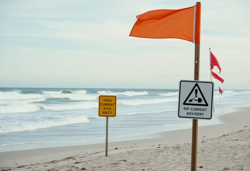
Charleston, SC, October 27, 2025 News Summary The National Weather Service has issued a rip current advisory for coastal South Carolina from 8 a.m. to 8 p.m. on Sunday, warning beachgoers...

Hilton Head Island, October 26, 2025 News Summary Xavier Alexander Rosa-Cabrera and Rey-Agustin Zamora-Perez were arrested on Hilton Head Island for cocaine distribution following a months-long investigation by the Beaufort County...

Hilton Head Island, October 26, 2025 News Summary Two men, Xavier Alexander Rosa-Cabrera and Rey-Agustin Zamora-Perez, were arrested for cocaine trafficking on Hilton Head Island following an investigation by local and...

Hilton Head Island, October 26, 2025 News Summary A significant drug bust occurred in Hilton Head Island, resulting in the arrest of two men for cocaine trafficking. Xavier Alexander Rosa-Cabrera and...

Hilton Head Island, October 25, 2025 News Summary Jaylen Sneed, a standout linebacker from Hilton Head Island, will play for the Notre Dame Fighting Irish in the College Football Playoff national...

Detroit, October 25, 2025 News Summary Detroit is gaining recognition as an affordable luxury real estate market, ranking among the top 10 in the U.S. with an entry point of $721,625...

Hilton Head Island, October 25, 2025 News Summary A serious ATV accident on Hilton Head Island resulted in critical injuries for a woman named Ashley Powers. The incident occurred on a...

Charleston, South Carolina, October 23, 2025 News Summary The National Weather Service has issued an elevated fire danger alert for southeastern South Carolina due to low humidity levels and gusty winds,...

News Summary A distinctive Mediterranean-style residence with 5,700 square feet of living space is on the market for $799,990 in West Columbia’s Quail Hollow neighborhood. Set on nearly an acre,...

News Summary The Spinx Company has completed the acquisition of the Buck Mickel Center from Greenville Technical College for $5.25 million. The property, covering 4.76 acres, features a multistory office...

Hilton Head Island, October 25, 2025 News Summary Gas prices on Hilton Head Island are currently impacting drivers as they adjust their budgets to rising costs. With the national average at...
Hilton Head Island, October 25, 2025 News Summary Hilton Head Island, a popular vacation spot, has a destination marketing fee that many guests may overlook. This optional charge varies among hotels...
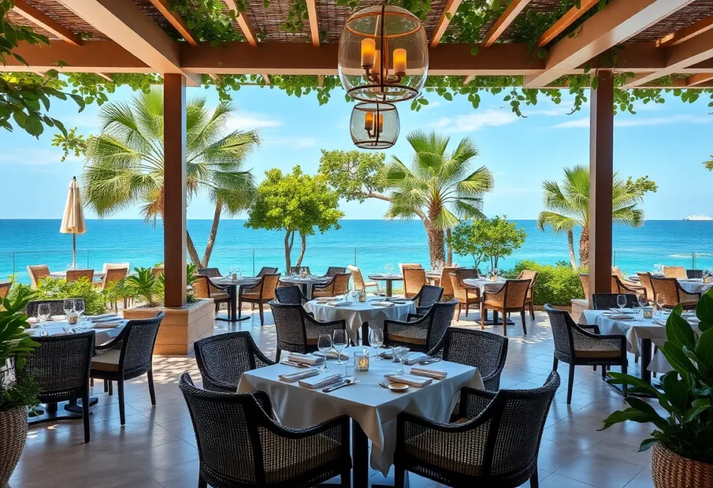
Hilton Head Island, SC, October 25, 2025 News Summary Sonesta Resort Hilton Head Island has launched the next phase of its luxury transformation, featuring new dining options including Seacrest Restaurant &...

News Summary Earth Fare, the natural and organic supermarket chain, will close all 50 of its stores across the U.S., including six in South Carolina. This decision follows ongoing financial...

News Summary The ongoing federal government shutdown is impacting small businesses in South Carolina, blocking approximately $11 million in loans weekly from the Small Business Administration. This has left thousands...

News Summary The Columbia Restaurant Group’s project for the Buccaneer Restaurant on Longboat Key remains unstarted nearly a decade after the purchase of the site. Despite hopes for a unique...

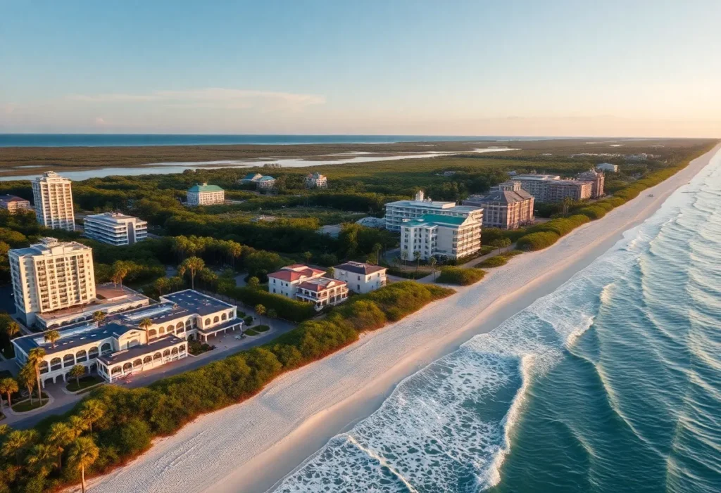
Hilton Head Island, SC, October 22, 2025 News Summary Hilton Head Island, SC, is experiencing an unprecedented boom in real estate, highlighted by the sale of a custom-built oceanfront home for...
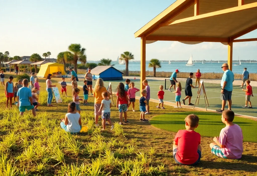
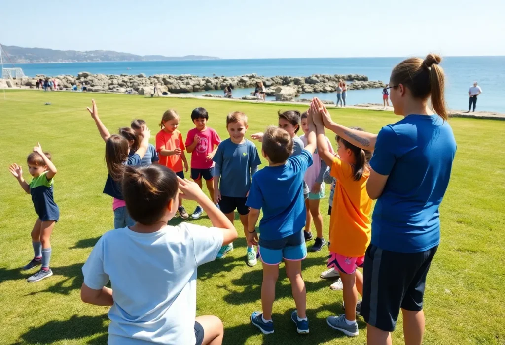
Hilton Head Island, SC, November 13, 2025 The sixth week of summer camps near Hilton Head Island brings a mix of outdoor adventures, creative workshops, and team-building games designed to promote...
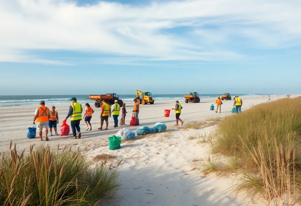
Hilton Head Island, South Carolina, November 13, 2025 Community-led efforts on Hilton Head Island have focused on preserving and enhancing the island’s natural landscapes despite a tight labor market. More than...

Bluffton, South Carolina, November 12, 2025 Residents of Bluffton, South Carolina came together to raise $620,000 for St. Jude Children’s Research Hospital through a combined golf tournament and evening gala. The...

Hilton Head, SC, November 12, 2025 Troy Williamson, a former University of South Carolina star and NFL wide receiver, now lives in Hilton Head, South Carolina, and dedicates his time to...
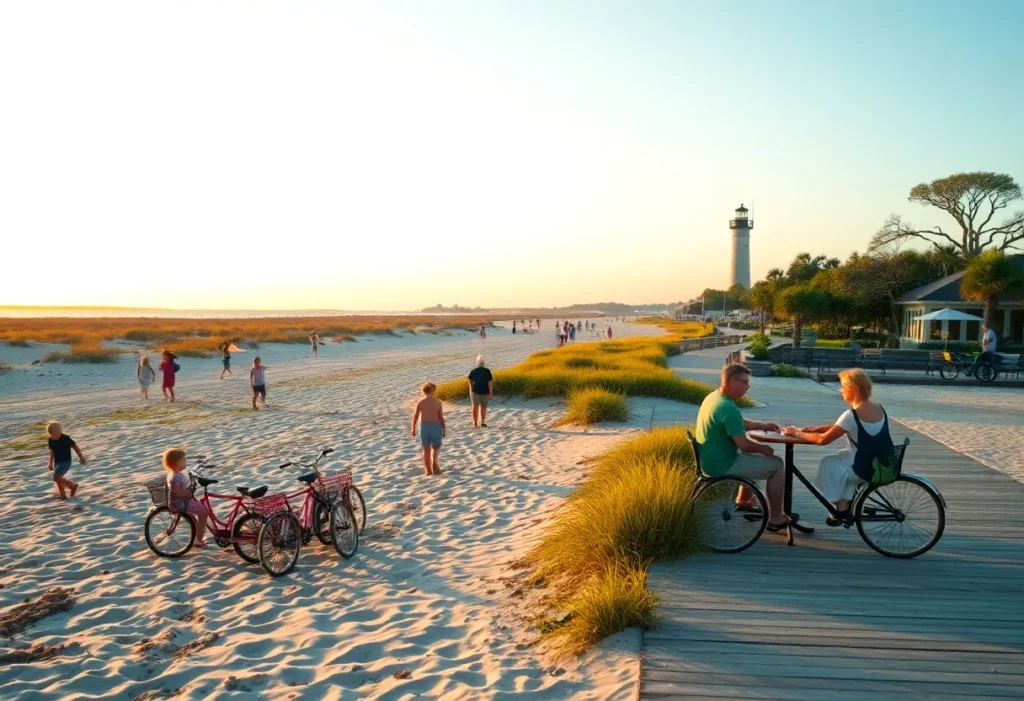
Hilton Head Island, SC, November 12, 2025 Hilton Head Island, South Carolina, has been recognized as an ideal destination for both young families and groups seeking a girls’ weekend. The island...

Hilton Head Island, South Carolina, November 11, 2025 Parents on Hilton Head Island are collaborating to share practical advice on safe infant feeding, emphasizing trusted brands available in local stores to...
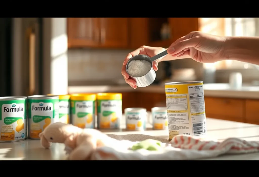
Hilton Head, SC, November 11, 2025 Families in Hilton Head are taking proactive steps to protect infants after nationwide testing found contaminants in many baby formulas. The FDA launched “Operation Stork...
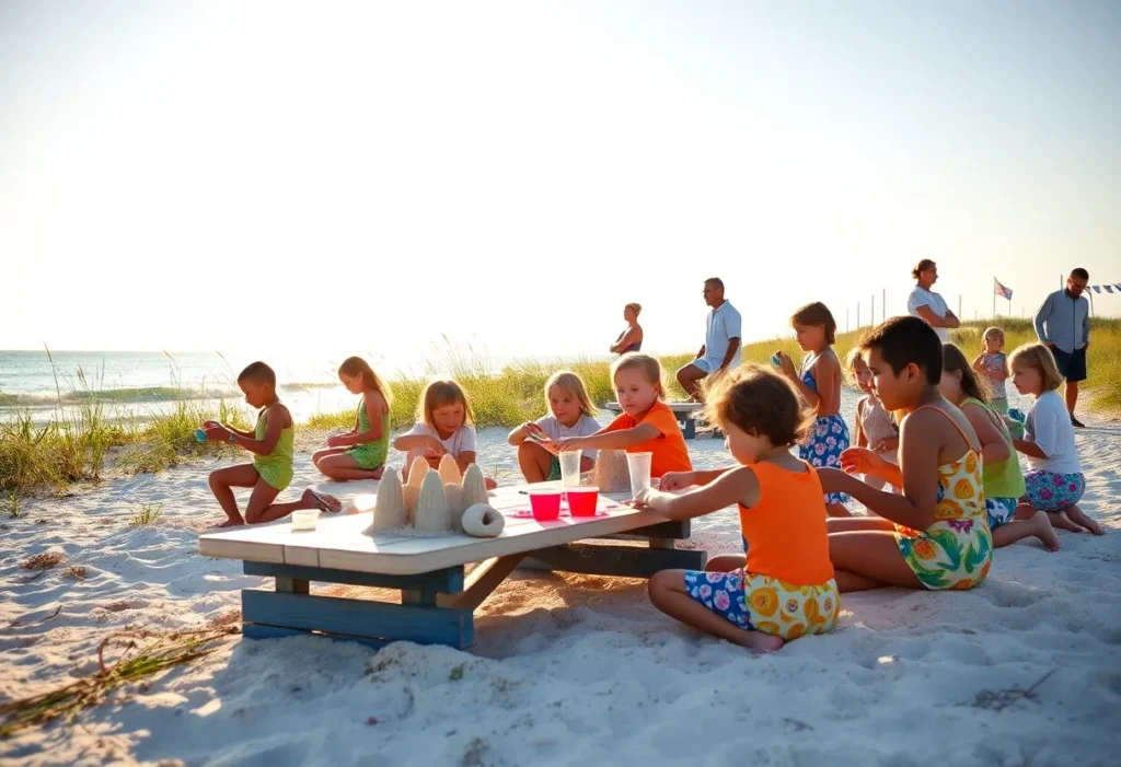
Hilton Head Island, SC, November 10, 2025 Families near Hilton Head Island are preparing for Summer Camp Week 4, a kid-friendly program of beach-themed activities, team-building exercises, and educational play that...
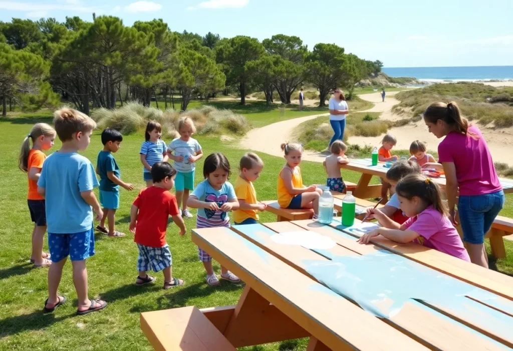
Hilton Head Island, South Carolina, November 10, 2025 Hilton Head Island’s Summer Camp Week 4 is underway, offering children a week of games, outdoor adventures and creative crafts designed to spark...
Hilton Head Island, October 26, 2025 News Summary Xavier Alexander Rosa-Cabrera and Rey-Agustin Zamora-Perez were arrested on Hilton Head Island for cocaine distribution following a months-long investigation by the Beaufort County...
Hilton Head Island, October 26, 2025 News Summary Two men, Xavier Alexander Rosa-Cabrera and Rey-Agustin Zamora-Perez, were arrested for cocaine trafficking on Hilton Head Island following an investigation by local and...
Hilton Head Island, October 26, 2025 News Summary A significant drug bust occurred in Hilton Head Island, resulting in the arrest of two men for cocaine trafficking. Xavier Alexander Rosa-Cabrera and...

Hilton Head, South Carolina, October 16, 2025 News Summary A federal lawsuit has been filed against the Beaufort County Sheriff’s Office and former Deputy Master Sgt. William ‘Billy’ Squires following an...

Hilton Head, October 16, 2025 News Summary Laquesha L. Habersham has filed a federal lawsuit against former Beaufort County Deputy William “Billy” Squires after he allegedly threatened her son and two...

St. Helena Island, South Carolina, October 13, 2025 News Summary A shooting at Willie’s Bar and Grill on St. Helena Island resulted in four fatalities and numerous injuries during a high...
Hilton Head, October 11, 2025 News Summary A former deputy with the Beaufort County Sheriff’s Office was fired after a shocking incident where he allegedly pointed a gun at a group...

Hilton Head Island, S.C., October 11, 2025 News Summary Harriet Kay Recker, an 82-year-old woman, has been charged with the premeditated murder of her husband, Dennis Recker, in a Hilton Head...

Hilton Head Island, October 8, 2025 News Summary A Beaufort County Sheriff’s deputy has been terminated after a troubling incident involving the pointing of a gun at teenagers in Hilton Head...

Charleston, SC, October 21, 2025 News Summary Congresswoman Nancy Mace has announced a $500,000 grant from the U.S. Department of Justice for Hopeful Horizons to enhance legal services for survivors of...

Hilton Head Island, South Carolina, October 17, 2025 News Summary William P. Squires, a former Beaufort County Master Sergeant, faces a lawsuit after allegedly pointing a loaded pistol at unarmed teenagers...

Hilton Head Island, SC, October 16, 2025 News Summary At the 29th Annual State of the Region luncheon on Hilton Head Island, Governor Henry McMaster celebrated South Carolina’s significant economic growth...

Hilton Head, September 20, 2025 News Summary Residents of Hilton Head recently attended a town council meeting where a proposed moratorium on short-term rentals, timeshares, and subdivisions was rejected. The council’s...
Hilton Head Island, September 18, 2025 News Summary The Hilton Head Island Town Council is considering a moratorium on new short-term rental properties due to rising community concerns. The proposed pause...

Hilton Head Island, SC, September 10, 2025 News Summary A recent cooking event in Hilton Head brought together Charleston Representative JA Moore and Hilton Head Representative Jeff Bradley to discuss the...

Hilton Head, SC, September 5, 2025 News Summary Lt. Gov. Pamela Evette has formally declared her intention to run for governor in South Carolina during a town hall meeting in Hilton...

Long Island, Puerto Rico, U.S. Virgin Islands, September 3, 2025 News Summary U.S. islands, including Long Island, Puerto Rico, and the U.S. Virgin Islands, saw unprecedented tourism growth in 2024. Long...
Hilton Head, SC, August 30, 2025 News Summary The Hilton Head Council is discussing a potential temporary moratorium on new short-term rentals in response to growing community frustrations. Residents are concerned...
Hilton Head Island, SC, November 13, 2025 The sixth week of summer camps near Hilton Head Island brings a mix of outdoor adventures, creative workshops, and team-building games designed to promote...
Bluffton, South Carolina, November 12, 2025 Residents of Bluffton, South Carolina came together to raise $620,000 for St. Jude Children’s Research Hospital through a combined golf tournament and evening gala. The...
Hilton Head, SC, November 12, 2025 Troy Williamson, a former University of South Carolina star and NFL wide receiver, now lives in Hilton Head, South Carolina, and dedicates his time to...

Hilton Head Island, South Carolina, November 9, 2025 Families on Hilton Head Island spent a day with coaches from Grambling State University in a hands-on sports and mentoring event. Coaches led...
Hilton Head Island, South Carolina, November 9, 2025 A Grambling State University coach led a youth sports event on Hilton Head Island focused on teamwork and mutual encouragement. Local children from...

Hilton Head Island, SC, October 31, 2025 Hilton Head Island’s youth sports programs offer a wide range of seasonal activities that encourage teamwork, skill development, and healthy habits. The Island Recreation...

Hilton Head Island, October 23, 2025 News Summary The Colleton County Cougars are set to face the Hilton Head Island Seahawks in a crucial matchup this Friday at 7:30 p.m. As...

News Summary Voting is now underway for The Island Packet’s High School Football Player of the Week in Hilton Head. Fans can cast their votes until Friday at noon for...

Hilton Head Island, South Carolina, October 20, 2025 PGA Tour star Patrick Cantlay recently met a 5-year-old fan at a community event near Hilton Head Island, creating a warm moment that...